Saturday, February 16, 2019

45. Kings Mountain National Military Park, South Carolina


               Hello!  Welcome back to our blog on the National Park Service.  In this post we travel south to the location of a major turning point in the American War of Independence, the battle of Kings Mountain.

Entrance Sign

BACKGROUND:
               While the situation of the American War of Independence had reached a stalemate in the northern colonies, the British had seen major successes in the south in 1779 and 1780.  Beginning with the capture of Savannah, the British had marched from to victory to victory, essentially evicting American forces out of Georgia, capturing Charleston, South Carolina, and shattering the only major American army in the south at the Battle of Camden.
               With American forces routed, the British hoped to capitalize on the greater amount of Loyalist support among the southern populace.  The British strategy called for Loyalist militias to shoulder the bulk of maintaining order in the south while the British regulars would march north, rolling up the colonies from the south and eventually pinning and destroying George Washington’s army in the north.  To do this, the British sent out veteran Major Patrick Ferguson, a noted marksman who had patented a new rifle design, to raise Loyalist troops and crack down on American supporters.  Ferguson’s heavy-handed tactics alienated the populace and galvanized American militiamen in the mountains of western North Carolina and eastern Tennessee.

The densely wooded forest in which the battle was fought.  The hilltop of Kings Mountain is at the center of the photo.

               In October of 1780, swarms of militiamen converged on Ferguson’s position at Kings Mountain, near the border between the two Carolinas.  Ferguson initially believed his position atop the prominent hilltop to be advantageous, but it soon turned into a death trap as the American militia completely encircled the Loyalists.  The militiamen charged up the hill, using frontier tactics to whittle away the Loyalist defenders.  At the height of the fighting, Ferguson fell from his horse, riddled with bullets from a volley of fire.  Loyalists began to attempt to surrender, but chaos reigned in the heat of battle and militiamen continued to gun down Loyalists until American commanders were finally able to regain control of the situation.
               With the destruction of Ferguson’s Loyalist force, the British strategy took a major blow as local support dried up and American forces engaged in a guerilla campaign.  The delay to British plans allowed the American army to regroup, leading to the decisive victory at Cowpens in January of 1781.

A monument atop Kings Mountain dedicated on the centennial of the victory in 1880.

THE MILITARY PARK:
               Kings Mountain National Military Park was established in 1931 following massive celebrations commemorating the 150th Anniversary of the battle the year prior.  The park preserves a huge tract of land surrounding the eponymous hill on which the battle was fought.  The park was originally much larger, but the entire eastern half was given over the state of South Carolina and converted into a state park.  The park is located in a very rural area and the combination of this and the sheer size of the park has allowed the battlefield to remain in near the same condition as it was during the battle.  In addition to the visitor center and the Battlefield Trail, the park includes horseback riding trails which overlap with the adjacent state park, and a backcountry campground.  The park is also the terminus of the Overmountain Victory National Historic Trail, which traces the routes used by militiamen to reach the battlefield at Kings Mountain.
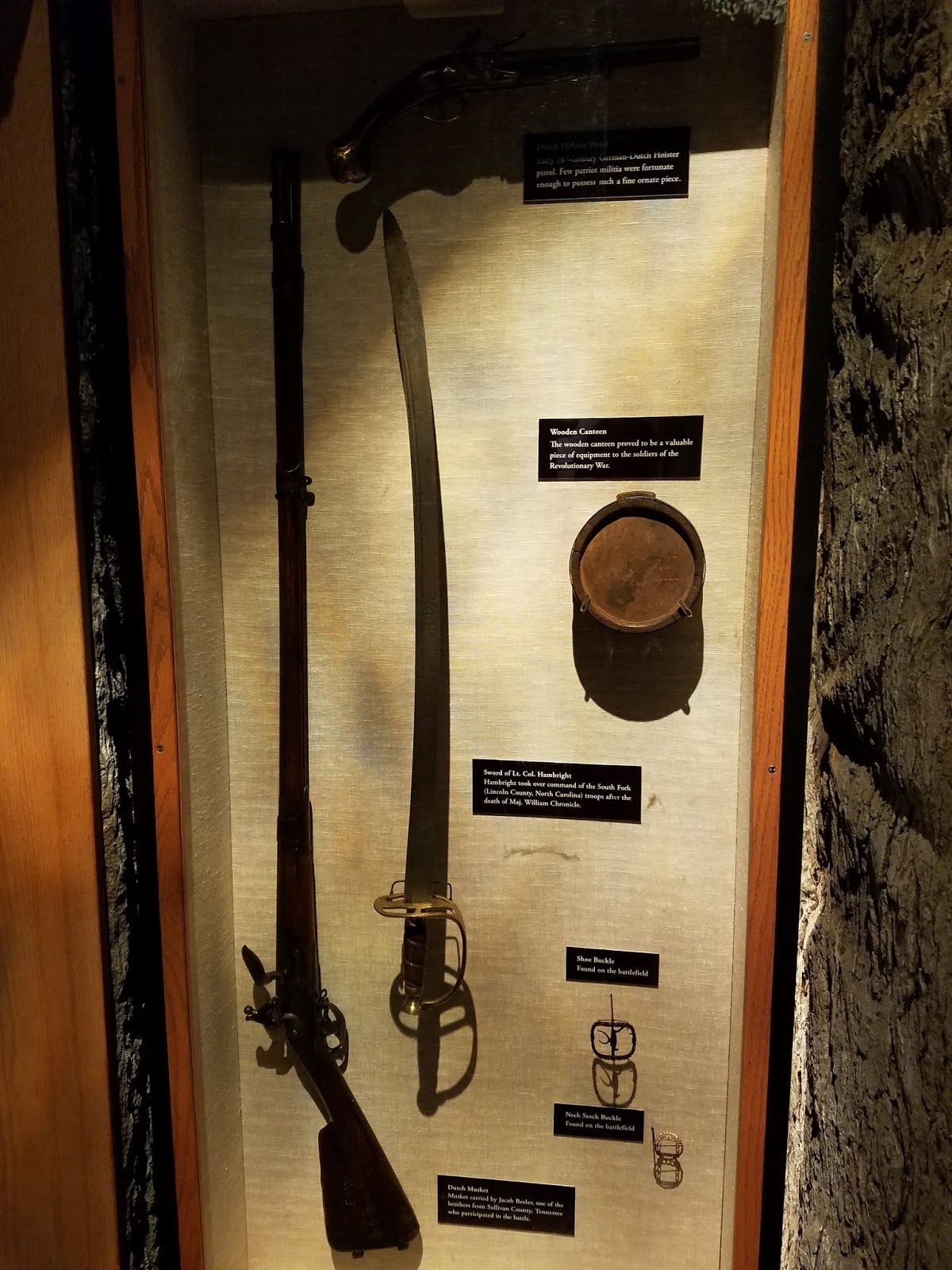
Artifacts belonging to American militiamen who fought in the battle on display in the visitor center.

TRAVEL TIPS:
               Kings Mountain National Military Park is located in northern South Carolina, roughly a forty-five-minute drive west of Charlotte, North Carolina.  It is possible to visit and walk the battlefield in less than two hours.  The visitor center contains a short film and exhibits on the battle including artifacts used by participants.  The Battlefield Trail is paved and handicapped accessible.  Passport stamps can be found in the visitor center.

ADDITIONAL PHOTOS:
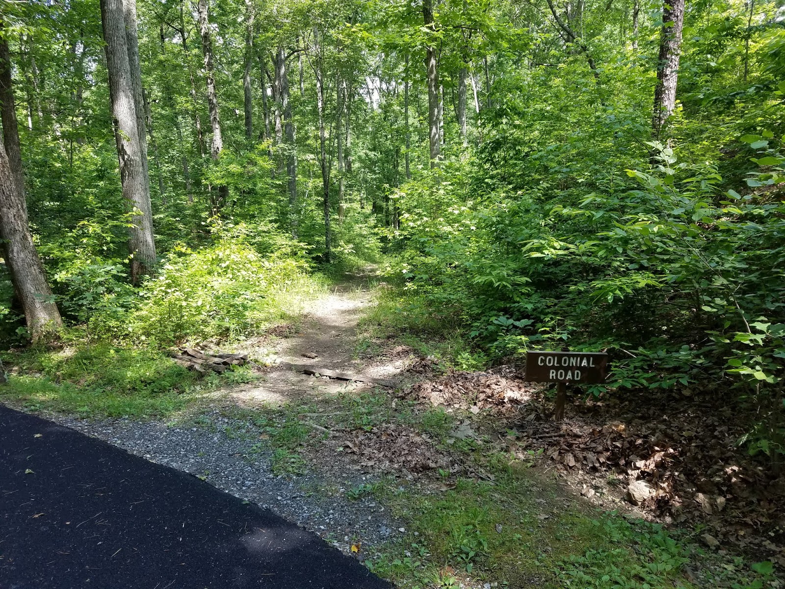
The trace of the colonial road which once ran past the hill.

A marker commemorating the 150th Anniversary celebrations in 1930 which were presided over by President Herbert Hoover.

A stone on the hilltop marking the spot where the British commander Major Ferguson was killed during the battle.

A topographical light board in the visitor center which reconstructs for visitors the events of the battle. 

The grave of Major Ferguson, located at the base of Kings Mountain.


Tuesday, January 8, 2019

44. Lincoln Home National Historic Site, Illinois


               Welcome back to our blog on the National Park Service.  In this post we make our third and final visit to an NPS unit dedicated to preserving a place associated with the life of President Abraham Lincoln.

Entrance sign.

BACKGROUND:
               In 1844, Abraham Lincoln purchased a home in Springfield, Illinois, the state capital.  Lincoln had moved to the city the previous decade, establishing his law practice, meeting and marrying his wife Mary Todd, and starting a family.  Lincoln would serve a single term in the U.S. House of Representatives from 1847 to 1849 while living in the home.  The next ten years he would continue with his law practice, arguing many cases before the Illinois Supreme Court.  In this time Abraham and Mary would have four children, Robert, Edward, Willie, and Tad, although Edward would die tragically young while they were living in Springfield.  Lincoln would embark on a failed run for the U.S. Senate in 1858, but his debates against Democrat Stephen Douglas brought him national attention.  In 1860, as the country was being torn apart over the issue of slavery, Lincoln was chosen as the Presidential nominee for the new Anti-Slavery Republican party.  Benefitting from a split in the Democrat party, Lincoln was elected the 16th President of the United States.  Southern states reacted to Lincoln’s election by seceding from the Union, plunging the country into the Civil War.

The Lincoln Home, at the corner of East Jackson and 8th streets in Springfield.

               Lincoln would never return to the house in Springfield, the only home he had ever owned.  Just as the Civil War was drawing to a close in a Union victory, he was assassinated by southern sympathizer John Wilkes Booth.  Lincoln became a martyr overnight, and was mourned across the north.  A funeral train brought his remains back to Springfield where he was later interred in a grand tomb.
               The Lincoln Home likewise became a national shrine.  Robert Todd Lincoln donated his parents’ house to the state of Illinois, which maintained the house as a state historic site.  In 1971 it was declared a National Historic Site under the jurisdiction of the National Park Service.

The extension of the parlor in the Lincoln Home where Abraham Lincoln accepted the Republican nomination for President in 1860.

THE HISTORIC SITE:
               Lincoln Home National Historic Site is located near the center of Springfield, Illinois.  The epicenter of the site is the Lincoln Home itself, fully restored and furnished with many original items according to its 1850’s appearance.  In addition to the Lincoln Home, a four-block area around the house centered on the corner of East Jackson and 8th Streets has also been restored as much as possible to their appearance at the time Lincoln was living at the home so that visitors may acquire a feeling for Lincoln’s neighborhood at that time period.  Several of the homes in the restored district are open to the public featuring exhibits on the neighborhood, Lincoln’s acquaintances, and restoration processes.  The visitor center for the site is located on the west side of the restored district on 7th Street.

A view looking southwest along 8th Street showing the restored neighborhood surrounding the Lincoln Home.

TRAVEL TIPS:
               The Lincoln Home National Historic Site is open year-round with major holiday exceptions from 8:30am to 5pm.  Tours of the Lincoln Home begin at 9am and run until 4:30pm.  Tickets to the house are free, although there is a $2 parking fee.  Tickets for the house tours are specifically timed and limited to fifteen people per tour and visitors are required to gather with a Ranger ten minutes before tours begin.  The remainder of the historic district is free to tour with most of the buildings open to the public.  Ranger programs and living history demonstrations are common and it is recommended to check the site’s schedule online before visiting.  The Lincoln Home is partially handicapped accessible.  The visitor center contains a short film and passport stamps can be found in the bookstore.
               For those visitors who would like a more complete Lincoln experience, it is recommended to also visit the Old State Capitol, where Lincoln served as a state legislator and argued cases before the state Supreme Court, and the Lincoln-Herndon Law Offices, which are both State Historic Sites and are located two blocks northwest of the site.  A block further north is the Abraham Lincoln Presidential Library and Museum.  Finally on the north side of Springfield, a five minute drive from the site, is Oak Ridge Cemetery, which is the location of the Lincoln tomb where the President is interred with his wife and three of his four sons.

The tomb of Abraham Lincoln.  The remains of the President are buried ten feet below the cenotaph, encased in several metal caskets and concrete to prevent the potential theft of his body which had been previously attempted.

ADDITIONAL PHOTOS:

The front entrance to the Lincoln-Herndon Law Office where Lincoln practiced law prior to his Presidency.

The Old State Capitol in Springfield.

The former Illinois Supreme Court chambers within the Old State Capitol where Lincoln argued many cases before the court.

The exterior of the Lincoln tomb.

The exterior of the Abraham Lincoln Presidential Library and museum.


Friday, November 16, 2018

43. Roger Williams National Memorial, Rhode Island


               Hello!  Welcome back to our blog as we travel in this post to the State of Rhode Island’s lone National Park Service Unit, Roger Williams National Memorial.
 
Entrance sign

BACKGROUND:
               In 1636, a colonist in Massachusetts named Roger Williams found himself on the wrong side of the law.  Williams, a Puritan minister, had been urging a separation from the Anglican church.  This however, was considered not just heretical, but also criminal as the head of the Anglican church was the King of England, and as such there was no separation of church and state.  Under threat of arrest, he fled Massachusetts to the southwest, finding a location on the headwaters of Narraganset Bay.  Several Indian Chiefs with whom Williams was friendly with gave him the land on which he formed his own government, the Colony of Rhode Island and Providence Plantations.  He dubbed the capital of his new colony “Providence,” meaning gift from God, and wrote into the colonial charter provisions that restricted laws to temporal and civil matters rather than spiritual, and guaranteed religious freedoms within the colony, creating the first government with a separation between church and state.  Roger Williams' example of religious freedom would later be enshrined in the First Amendment to the United States Constitution.

               To honor not just the man who founded both Rhode Island and its capital city of Providence, but also the first champion of religious liberty in America, Congress authorized the creation of a National Memorial in Providence on the location of Williams’ original settlement.  After acquiring and clearing the authorized land, a large public park was created to serve as the memorial.
 
Roger Williams National Memorial as seen from the north.

THE MEMORIAL:
               Roger Williams National Memorial consists of a large rectangular public park in the center of downtown Providence, opposite the Rhode Island state capitol building.  The park lies on the site where Roger Williams first settled Rhode Island and Providence.  There are several memorials and interpretive signs throughout the park but it is largely green-space.  A small visitor center built within an historic colonial home is located at the park’s northeast corner.  Fittingly, Roger Williams overlooks the park, as his grave-site is directly uphill to the east, with his statue atop his grave looking down on the city from above.
 
The grave of Roger Williams, overlooking the memorial and the city.

TRAVEL TIPS:
               The Roger Williams National Memorial is easily accessible within the center of Providence Rhode Island.  There is limited parking at the Memorial so visitors will mostly need to use street parking.  The park is a public space and is open at all hours and seasons, however the visitor center is only open from 9:00am-4:30pm.  The park is handicapped accessible and the visitor center contains a short film and passport stamps.  For those visitors who are interested, the Roger Williams gravesite is a relatively short, though very steeply uphill, walk away.

ADDITIONAL PHOTOS:
The memorial visitor center.

The well at the center of the park marking the spot where Roger Williams founded both Providence and Rhode Island.

This building opposite the well stands on the place where Roger Williams' house once stood, as indicated by the plaque between the second and third floors.

A view of the park from the south.

A memorial on the park grounds to Gabriel Bernon, a Huguenot who came to Providence fleeing religious persecution in France. 
A view of the Rhode Island State Capitol from the Memorial.


Thursday, October 25, 2018

42. Gateway Arch National Park, Missouri


               Welcome back to our blog on the National Park Service.  In this post we are visiting our newest and smallest addition to the “Big 60” National Parks, Gateway Arch National Park in St. Louis.

Entrance sign with a view of the Gateway Arch.

BACKGROUND:
               Since the Louisiana Purchase in 1803, the city of St. Louis had been seen as the gateway to the west.  To commemorate the momentous event which paved the way for the expansion of the United States from sea to shining sea, a movement began in the 1930s to build a suitable memorial in St. Louis.  The plan called for a large public park along the St. Louis waterfront on the west bank of the Mississippi river, crowned with a massive monument, preferably an arch.  Although the land was cleared by 1942, and the Old Courthouse which had been the scene of the first phase of the infamous Dred Scott court case was incorporated into the plan, work on the memorial stalled twice due to World War Two and the Korean War.
               Finally, in 1961 work began on the grand memorial, the centerpiece of which would be a massive stainless-steel arch that would become the defining feature of the St. Louis skyline.  Originally titled Jefferson National Expansion Memorial, the Gateway Arch was opened to the public in 1968 under the jurisdiction of the National Park Service.

The Gateway Arch.

               In the 2010s, a massive renovation of the arch took place, including reshaping the grounds of the memorial.  To cap off the renovation, by an act of Congress, in 2018 the memorial was re-designated Gateway Arch National Park, becoming the first National Park in the state of Missouri, as well as the smallest National Park in the country.

THE PARK:
               Covering an area of barely 91 acres in downtown St. Louis on the west bank of the Mississippi river, Gateway Arch National Park is the smallest of the “Big 60” National Parks.  The park consists of three main features.  The foremost of these is the titular Gateway Arch, located at the center of the park space.  The arch itself is hollow, with a unique tram system that transports visitors to the pinnacle observation deck.  Underground below the arch is the visitor center and the Museum at the Gateway Arch, previously the Museum of Westward Expansion, which tells the story of the Louisiana Purchase, the evolution of St. Louis, and the westward expansion of the country.

The center hallway of the Museum at the Gateway Arch.

               The second feature of the park is its 90 acres of public park space surrounding the arch.  The rectangular plot holds two ponds on the north and south flanks of the arch, with a grand staircase leading to the Mississippi river, and sculpted park lands.  Located in the park’s southwest corner is the Old Cathedral, a Catholic Church dating from the early 1800s.  Along the waterfront is a dock for two replica 19th Century paddleboat steamships that take visitors for short cruises along the river.
               The third feature of the park is the Old Courthouse, directly west of the Gateway Arch.  Originally constructed in stages from 1816-64, the courthouse is most famous as the scene of the initial trial of the Dred Scott case prior to the Civil War.  Scott, a slave whose master had died while the two were traveling in a northern free state sued for his freedom on the grounds that as the master had died while Scott was in a free state he was no longer the property of the man’s descendants still in the south.  Scott won the case when it was put to trial at the Old Courthouse in St. Louis, but the ruling was struck down in outrageous fashion by the Supreme Court, an event which enflamed the attitudes of abolitionists in the north and contributed to the outbreak of the Civil War.

A view of the Old Courthouse and downtown St. Louis taken from the observation deck of the Gateway Arch.  The Old Cathedral can be seen at lower left, while the circular structure at bottom center is the new main entrance to the arch and museum.

TRAVEL TIPS:
               Gateway Arch National Park has varying hours of operation.  The Old Courthouse is open from 8am to 4:30pm, and the Old Cathedral as a still active Catholic congregation holds regular masses as well as hosting tours of its own.  The Gateway Arch is open for tours from 8am to 10pm during the summer and 9am to 6pm in the winter.  Tours to the top using the tram system are specific to a time of your choosing when purchasing tickets.  Tickets can be bought at the Gateway Arch, but it is recommended to purchase them in advance online.  Also, due to security concerns, all visitors wishing to enter into the museum below ground and tour the arch must go through airport style security checkpoints.  Tours to the top of the arch are also not recommended for those suffering from claustrophobia, as the capsules that transport visitors on the tram are extremely cramped.  While the grounds, Old Courthouse, and museum are handicapped accessible, the arch tram is not.  Passport stamps can be found at the reception desk just inside the main entrance to the museum.  (As of this writing, passport stamp collectors are still allowed to use the obsolete Jefferson National Expansion Memorial stamp as well.)

A view of the interior of the capsules used by the arch tram.  Even from this photo, the capsule is far less spacious than it appears.

ADDITIONAL PHOTOS:

A plaque on the observation deck showing the height at the pinnacle of the arch.

Artifacts from exploring expeditions to west during the early 1800s on display in the museum.

A model in the museum showing the St. Louis riverfront during the mid 1800s.

The interior of the Old Cathedral taken shortly after the conclusion of Sunday Mass.

The exterior facade of the Old Cathedral.

A view of the riverfront dock with the two replica steam paddleboats moored alongside.

A statue commemorating the return of Captains Merriwether Lewis and William Clark to St. Louis upon the conclusion of their epic journey to the Pacific Coast.

A ground level view of the Old Courthouse.

A statue depicting Dred Scott and his wife in front of the Old Courthouse.

A view of the rotunda of the Old Courthouse.

A view taken from the base of the Gateway Arch.


Wednesday, October 10, 2018

41. Tupelo National Battlefield, Mississippi


Welcome back to our blog!  In this post we follow up on our earlier post about Brices Cross Roads NBS with its identical twin, the nearby Tupelo National Battlefield.

Entrance Sign

BACKGROUND:
               Following the Union’s humiliating defeat at the battle of Brices Cross Roads in June of 1864, General William T. Sherman, whose offensive into Georgia required securing supply lines in Mississippi, sent out an order to his subordinates to find and crush the Confederate force under the command of Nathan Bedford Forrest.
               Forrest had been hoping to lure the Union into a trap south of Tupelo, Mississippi.  However, Union General Andrew Smith bypassed Forrest and instead marched straight to Tupelo, forcing Forrest to attack in order to retake the town.  The following attacks against the prepared Union troops went badly with the Confederates taking heavy casualties including even Forrest himself being wounded.  Although Forrest would continue to harass the Union in later months, the battle of Tupelo put his force out of action allowing Sherman to continue his drive on Atlanta.

THE BATTLEFIELD:
               Most of the Tupelo battlefield was swallowed up by development as the town expanded over the years.  Now, aside from a few acres on the edge of town preserved by the Civil War Trust, only a one-acre plot in the middle of Tupelo has been preserved under the jurisdiction of the National Park Service.  The site itself is nearly identical to Brices Cross Roads National Battlefield Site, consisting of a simple monument flanked by a pair of cannons.

A view of the entirety of the NPS unit.

TRAVEL TIPS:
               Tupelo National Battlefield is easily accessible, located on Main Street in Tupelo, Mississippi.  The battlefield is administered by the Natchez Trace Parkway, which passes through Tupelo, and does not have a dedicated NPS visitor center. Similar to Brices Cross Roads NBS, visitors can find information on the battle at the Mississippi Final Stands Interpretive Center in nearby Baldwyn, where passport stamps can be found.  Passport Stamps can also be found at the NPS Natchez Trace Parkway visitor center located on the edge of town.